
𐍆𐌴𐌹𐌻𐌰:Mexico (orthographic projection).svg

Size of this PNG preview of this SVG file: 550 × 550 𐍆𐍂𐌹𐍃𐌰𐌷𐍄𐌹𐍃𐍄𐌰𐌱𐌴𐌹𐍃. Other resolutions: 240 × 240 𐍆𐍂𐌹𐍃𐌰𐌷𐍄𐌹𐍃𐍄𐌰𐌱𐌴𐌹𐍃 | 480 × 480 𐍆𐍂𐌹𐍃𐌰𐌷𐍄𐌹𐍃𐍄𐌰𐌱𐌴𐌹𐍃 | 768 × 768 𐍆𐍂𐌹𐍃𐌰𐌷𐍄𐌹𐍃𐍄𐌰𐌱𐌴𐌹𐍃 | 1,024 × 1,024 𐍆𐍂𐌹𐍃𐌰𐌷𐍄𐌹𐍃𐍄𐌰𐌱𐌴𐌹𐍃 | 2,048 × 2,048 𐍆𐍂𐌹𐍃𐌰𐌷𐍄𐌹𐍃𐍄𐌰𐌱𐌴𐌹𐍃.
𐍆𐍂𐌿𐌼𐌹𐍃𐍄 𐍆𐌰𐌾𐌻 (SVG file, nominally 550 × 550 pixels, file size: 376 KB)
𐌼𐌰𐌿𐍂𐌲𐌿𐍃 𐍃𐌺𐌴𐌹𐍂𐌴𐌹𐌽𐍃
| 𐍃𐌺𐌴𐌹𐍂𐌴𐌹𐌽𐍃 |
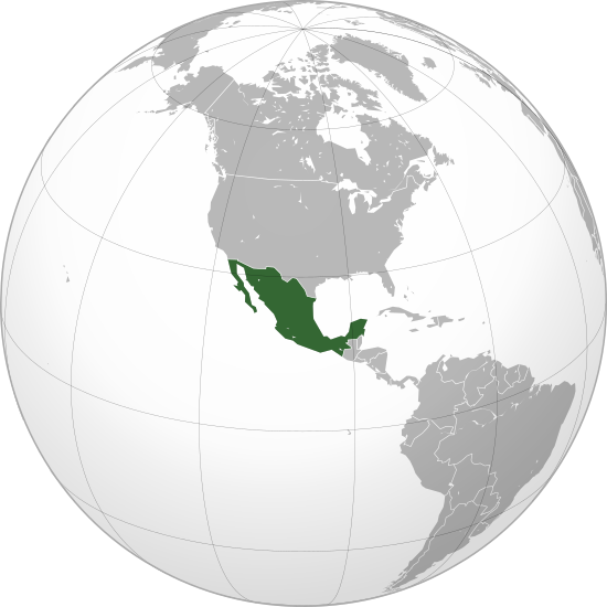
English: Mexico |
||||
| Date | |||||
| 𐌱𐍂𐌿𐌽𐌽𐌰 |
𐍃𐍅𐌴𐍃 𐍅𐌰𐌿𐍂𐍃𐍄𐍅 (Original text: Own work,)
|
||||
| 𐌱𐍉𐌺𐌰𐍂𐌴𐌹𐍃 | Ssolbergj | ||||
| Other versions |
Derivative works of this file: Map ITESM campuses by city.svg .svg)
|
||||
| SVG genesis |

.svg)
.svg)
.svg)
.svg)
.svg)
.svg)
.svg)
.svg)
.svg)
.svg)
.svg)
.svg)
.svg)
.svg)
.svg)
.svg)
.svg)
.svg)
.svg)
.svg)
.svg)
.svg)
.svg)
.svg)
.svg)
.svg)
.svg)
.svg)
.svg)
.svg)
.svg)
.svg)
.svg)
.svg)
.svg)
.svg)
.svg)
.svg)
.svg)
.svg)
.svg)
.svg)
.svg)
.svg)
.svg)
.svg)
.svg)
.svg)
.svg)
.svg)
.svg)
.svg)
.svg)
.svg)
.svg)
.svg)
.svg)
.svg)
.svg)
.svg)
.svg)
.svg)
.svg)
.svg)
.svg)
.svg)
.svg)
.svg)
.svg)
.svg)
.svg)
.svg)
.svg)

.svg)

.svg)

.svg)
.svg)
.svg)
.svg)
.svg)
.svg)
.svg)


.svg)
.svg)
.svg)
.svg)
.svg)
.svg)
.svg)

.svg)
.svg)
.svg)
.svg)
.svg)
.svg)
.svg)
.svg)
.svg)

.svg)
.svg)
.svg)
.svg)
.svg)
.svg)
.svg)
_without_national_boundaries.svg)
.svg)
.svg)
.svg)
.svg)
.svg)
.svg)

.svg)
.svg)
.png)
.svg)
.svg)
.svg)
.svg)

.svg)
.svg)
.svg)
.svg)
.svg)
.svg)
.svg)
.svg)
.svg)
.svg)
.svg)

.svg)
.svg)
.svg)
.svg)
.svg)
.svg)
.svg)
.svg)
.svg)

.svg)
.svg)

.svg)
.svg)
.svg)
.svg)
.svg)
.svg)
.svg)
.svg)
.svg)
.svg)
.svg)
.svg)
.svg)
.svg)
.svg)
.svg)
.svg)
.svg)
.svg)
.svg)
.svg)
.svg)
.svg)
.svg)
.svg)
.svg)
.svg)
_-_Crimea_disputed.svg)
.svg)
.svg)
.svg)
.svg)
.svg)
.svg)
.svg)
.svg)
.svg)
.svg)
.svg)
_political.svg)
.svg)
.svg)
.svg)
.svg)
_-_Crimea_disputed_-_no_borders.svg)
.svg)
.svg)
.svg)
.svg)
.svg)
.svg)
.svg)
.svg)
.svg)
.svg)
.svg)

.svg)
.svg)
.svg)

.png)
.svg)
.svg)
.svg)
.svg)
.svg)
.svg)
.svg)
.svg)
.svg)
.svg)
.svg)
.svg)
.svg)
.svg)
.svg)
.svg)
.svg)
.svg)
.svg)
.svg)
.svg)
.svg)
.svg)
.svg)
.svg)
.svg)
.svg)
.svg)
.svg)
.svg)
.svg)
.svg)
.svg)
.svg)
.png)
.svg)
.svg)
.svg)
_(orthographic_projection).png)
.svg)
.svg)
.svg)
Licensing
I, the copyright holder of this work, hereby publish it under the following license:
This file is licensed under the Creative Commons Attribution 3.0 Unported license.
- 𐌰𐌽𐌳𐌻𐌴𐍄𐌰𐌽 𐌹𐍃𐍄 𐌸𐌿𐍃:
- 𐌳𐌿 𐌳𐌰𐌹𐌻𐌾𐌰𐌽 – to copy, distribute and transmit the work
- 𐌳𐌿 𐌱𐌻𐌰𐌽𐌳𐌰𐌽 – to adapt the work
- Under the following conditions:
- attribution – You must give appropriate credit, provide a link to the license, and indicate if changes were made. You may do so in any reasonable manner, but not in any way that suggests the licensor endorses you or your use.
𐍆𐌰𐌾𐌻𐌰𐍃𐍀𐌹𐌻𐌻
𐌰𐍄𐍄𐌴𐌺 𐌳𐌰𐌲/𐌼𐌴𐌻 𐌳𐌿 𐌱𐌰𐌽𐌳𐍅𐌾𐌰𐌽 𐍆𐌰𐌾𐌻 𐍃𐍅𐌰𐍃𐍅𐌴 𐌲𐌰𐌱𐌰𐌹𐍂𐌷𐍄𐌹𐌳𐌰 𐌹𐌽 𐌸𐌰𐌼𐌼𐌰 𐌼𐌴𐌻𐌰.
| 𐌼𐌴𐌻 | 𐌻𐌴𐌹𐍄𐌹𐌻𐌰 𐍆𐍂𐌹𐍃𐌰𐌷𐍄𐍃 | 𐍅𐌰𐌷𐍃𐍄𐌿𐍃 | 𐌱𐍂𐌿𐌺𐌾𐌰𐌽𐌳𐍃/𐌱𐍂𐌿𐌺𐌾𐌰𐌽𐌳𐌹 | 𐍅𐌰𐌿𐍂𐌳 | |
|---|---|---|---|---|---|
| 𐌽𐌿 | 23:20, 18 𐌾𐌹𐌿𐌻𐌴𐌹𐍃 2009 | | 550 × 550 (376 KB) | Keepscases | Margins |
| 21:06, 21 𐌰𐌿𐌺𐍄𐍉𐌱𐌰𐌹𐍂 2008 |  | 541 × 541 (376 KB) | Ssolbergj | {{Information |Description={{en|1=aefv}} |Source=eav |Author=aedfv |Date=aerv |Permission=eaw |other_versions=ear }} werv <!--{{ImageUpload|full}}--> Category:Maps of Mexico |
𐍆𐌰𐌾𐌻𐌰𐌱𐍂𐌿𐌺𐌴𐌹𐌽𐍃
𐌰𐍆𐍄𐌿𐌼𐌰 𐍃𐍉 𐍃𐌴𐌹𐌳𐍉 𐌻𐌴𐌹𐌽𐌺𐍉𐌸 𐌸𐌹𐌶𐍉𐌶𐌿𐌷 𐍆𐌴𐌹𐌻𐍉𐍃
𐌱𐍂𐌿𐌺𐌴𐌹𐌽𐍃 𐍆𐌰𐌾𐌻𐌴 𐌰𐌻𐌻𐌰𐌹𐌼 𐍃𐍄𐌰𐌳𐌹𐌼
𐌸𐍉 𐌹𐍆𐍄𐌿𐌼𐍉𐌽𐌰 𐌰𐌽𐌸𐌰𐍂𐌰 𐍅𐌹𐌺𐌾𐌰 𐌱𐍂𐌿𐌺𐌾𐌰𐌽𐌳 𐌸𐌹𐍃 𐍆𐌰𐌾𐌻𐌹𐍃:
- 𐌱𐍂𐌿𐌺𐌴𐌹𐌽𐍃 𐌰𐌽𐌰 ady.wikipedia.org
- 𐌱𐍂𐌿𐌺𐌴𐌹𐌽𐍃 𐌰𐌽𐌰 af.wikipedia.org
- 𐌱𐍂𐌿𐌺𐌴𐌹𐌽𐍃 𐌰𐌽𐌰 alt.wikipedia.org
- 𐌱𐍂𐌿𐌺𐌴𐌹𐌽𐍃 𐌰𐌽𐌰 ar.wikipedia.org
- 𐌱𐍂𐌿𐌺𐌴𐌹𐌽𐍃 𐌰𐌽𐌰 arz.wikipedia.org
- 𐌱𐍂𐌿𐌺𐌴𐌹𐌽𐍃 𐌰𐌽𐌰 as.wikipedia.org
- 𐌱𐍂𐌿𐌺𐌴𐌹𐌽𐍃 𐌰𐌽𐌰 az.wiktionary.org
- 𐌱𐍂𐌿𐌺𐌴𐌹𐌽𐍃 𐌰𐌽𐌰 ba.wikipedia.org
- 𐌱𐍂𐌿𐌺𐌴𐌹𐌽𐍃 𐌰𐌽𐌰 be.wikipedia.org
- 𐌱𐍂𐌿𐌺𐌴𐌹𐌽𐍃 𐌰𐌽𐌰 bg.wikipedia.org
- 𐌱𐍂𐌿𐌺𐌴𐌹𐌽𐍃 𐌰𐌽𐌰 bm.wikipedia.org
- 𐌱𐍂𐌿𐌺𐌴𐌹𐌽𐍃 𐌰𐌽𐌰 bn.wikipedia.org
- 𐌱𐍂𐌿𐌺𐌴𐌹𐌽𐍃 𐌰𐌽𐌰 bxr.wikipedia.org
- 𐌱𐍂𐌿𐌺𐌴𐌹𐌽𐍃 𐌰𐌽𐌰 ca.wikipedia.org
- 𐌱𐍂𐌿𐌺𐌴𐌹𐌽𐍃 𐌰𐌽𐌰 ca.wikinews.org
- 𐌱𐍂𐌿𐌺𐌴𐌹𐌽𐍃 𐌰𐌽𐌰 ceb.wikipedia.org
- 𐌱𐍂𐌿𐌺𐌴𐌹𐌽𐍃 𐌰𐌽𐌰 ckb.wikipedia.org
- 𐌱𐍂𐌿𐌺𐌴𐌹𐌽𐍃 𐌰𐌽𐌰 crh.wikipedia.org
- 𐌱𐍂𐌿𐌺𐌴𐌹𐌽𐍃 𐌰𐌽𐌰 cs.wikipedia.org
- 𐌱𐍂𐌿𐌺𐌴𐌹𐌽𐍃 𐌰𐌽𐌰 cs.wikiquote.org
- 𐌱𐍂𐌿𐌺𐌴𐌹𐌽𐍃 𐌰𐌽𐌰 da.wikipedia.org
- 𐌱𐍂𐌿𐌺𐌴𐌹𐌽𐍃 𐌰𐌽𐌰 de.wikipedia.org
- 𐌱𐍂𐌿𐌺𐌴𐌹𐌽𐍃 𐌰𐌽𐌰 en.wikipedia.org
- List of sovereign states and dependent territories in North America
- Wikipedia:Userboxes/Location/Mexico
- Outline of Mexico
- Talk:European Union/Archive 22
- Mexico–Yugoslavia relations
- Template:User United Mexican States
- User:Wexeb
- User:Wexeb/Userboxes
- User:Chanterele
- User:De leeuw blauw
- User:AlexR.L.
- User:Sagleranorto/Jordglobskartor
- User:Gossip-Girlxox
- User:Alfonsobouchot
- User:Emilianogarciag
- User:Kusagami142
- User:Googolplanck
- User:Maquedasahag
- List of butterflies of Mexico
- User:SubSevenMoRpHeEuS
View more global usage of this file.
.svg)
.svg)